Understanding the Name: Is There a Difference Between Bosnia and Herzegovina?
When travelers look at a map or plan a journey to the heart of the Balkans, they often encounter the unified name: Bosnia and Herzegovina. This distinctive double-barreled title frequently leads to questions about the geography, history, and political structure of the nation. To understand the difference between the two, one must look past modern borders and into the complex, layered history of the region.
The Historical Context of the Names
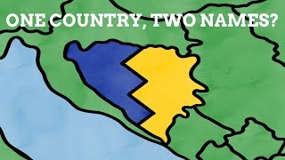
The distinction between Bosnia and Herzegovina is primarily historical and geographical rather than a division between two separate, independent states. For centuries, these two regions were distinct entities that eventually became intertwined through geopolitical shifts, foreign rule, and administrative reform.
Bosnia, the larger northern region, takes its name from the Bosna River. Historically, it was a medieval kingdom that held significant influence in the Balkans before falling under Ottoman rule in the 15th century. It served as a central hub for trade, culture, and religious exchange for hundreds of years.
Herzegovina, the smaller southern region, has a name rooted in a specific title. The term "Herzegovina" is derived from the German word Herzog, meaning "Duke." In the 15th century, a local nobleman named Stjepan Vukčić Kosača declared himself the "Herceg" (Duke) of St. Sava. His territory became known as the Hercegovina, or the "Duke’s Land." Over time, this southern region maintained a distinct identity characterized by its rugged, karst landscape and Mediterranean climate, differing from the forested mountains of the north.
Geographical Differences
While the two regions are now united under one sovereign government, they feature distinct physical characteristics that reflect their unique identities:
- The North (Bosnia): This region is largely defined by dense forests, rolling hills, and the Dinaric Alps. The climate here is continental, with cold, snowy winters and warm summers. It houses the capital city, Sarajevo, which sits in a valley surrounded by these imposing mountains.
- The South (Herzegovina): As you move toward the Adriatic coast, the landscape shifts dramatically. Herzegovina is known for its rocky, barren terrain, limestone plateaus, and a climate that leans toward the Mediterranean. It is famous for its sun-drenched vineyards, the emerald waters of the Neretva River, and the iconic stone bridge in Mostar.
Political Structure Today
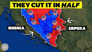
Since the end of the Bosnian War in the 1990s, the political structure of the country has been defined by the Dayton Agreement. It is important to note that the country is not divided strictly into "Bosnia" and "Herzegovina" as administrative zones. Instead, the country is composed of two main political entities:
- The Federation of Bosnia and Herzegovina: This entity covers a large portion of the country and includes both the central Bosnian heartland and parts of the southern Herzegovina region.
- Republika Srpska: This entity occupies the northern and eastern parts of the country.
- Brčko District: A self-governing administrative unit that acts as a neutral point within the country.
This complex system was designed to ensure power-sharing among the three main ethnic groups: Bosniaks, Serbs, and Croats. Consequently, while the names "Bosnia" and "Herzegovina" remain essential to the cultural and historical identity of the land, they do not function as separate, autonomous states today.
Cultural Significance and Identity
For the people living in the country, the distinction is often a matter of regional pride. Residents of Mostar or Trebinje may proudly identify as Herzegovinian, emphasizing the specific traditions, culinary habits, and dialects of the south. Similarly, those living in the central or northern regions identify with the Bosnian history of the Ottoman and Austro-Hungarian eras.
Despite these regional nuances, there is